Camel's Hump - Burrows Trail - Vermont
June 27th, 2011

Following my rainy hike of Mount Mansfield the previous day, we woke up to beautiful sunny morning in Stowe. After a good breakfast we made the short drive from Stowe to the Burrows trailhead a few miles away. A word of warning to anyone trying to find their way to this trailhead, it's best to use a GPS to find your way as there seemed to be quite a few missing sign posts along the way and I was happy I didn't have to rely on my printed directions.
I had decided on the Burrows Trail for a couple of reasons. First and foremost I wanted to find the shortest route up because Renee was going to be hiking with me again and after putting her through the "torture" of the 14 mile hike up Mount Marcy the year before I wanted this hike to be much more pleasant. Secondly, I had read that the Long Trail lead to some exposed spots near the top and I had concerns about that for her. The most obvious choice was the Burrows Trail and I'm happy to report that it was the right choice.
Though it was a Monday morning, the parking lot was already near capacity, but considering the status that Camel's Hump has for the citizens of Vermont, it's not surprising. They were probably choosing this hike for the same reason I did. It's clearly a unique mountain in terms of appearance and the lack of development (compared to the other top mountains of Vermont). One of the most appealing things about hiking is to get out in to nature and experience a wilderness "untouched" by man. Camel's Hump fit the bill and by 10:30am we were heading up Burrows Trail through lush green forests.


We came more prepared for this hike as well, bringing the now essential hiking gear... hiking poles! Yes, I'm now a convert and will continually promote their use for a better hiking experience. Better for your knees, better for balance, easier on your leg muscles, less chances of twisting your ankle... do I need to convince you anymore? The only kind of hike that I would not use poles would be ones that require extensive scrambling, then they would just become a burden... other than that, why not use them? Ok, enough of my promoting.


For the next 2 hours we hiked along the tree covered trail, which was a blessing since it was a hot day and the sun was shining bright, though it obscured any view of the peak. The trail conditions were pretty good considering all the rain that had come through the area over the last few days. There was a nice stream that followed near the trail for the first mile or so and we pretty much had the trail to ourselves even with the packed parking lot.


As we made our way further up the mountain we began to meet up with other hikers and started to get the sense that we must be getting close now. Unfortunately for Renee, it was the first time she tried an extended hike in a pair of light hiking shoes she had had for a while, and sure enough they were starting to give her some bad blisters on her heels. We took a break and even exchanged boots for a while to see if that would help things, but really what can you do once you have a blister?
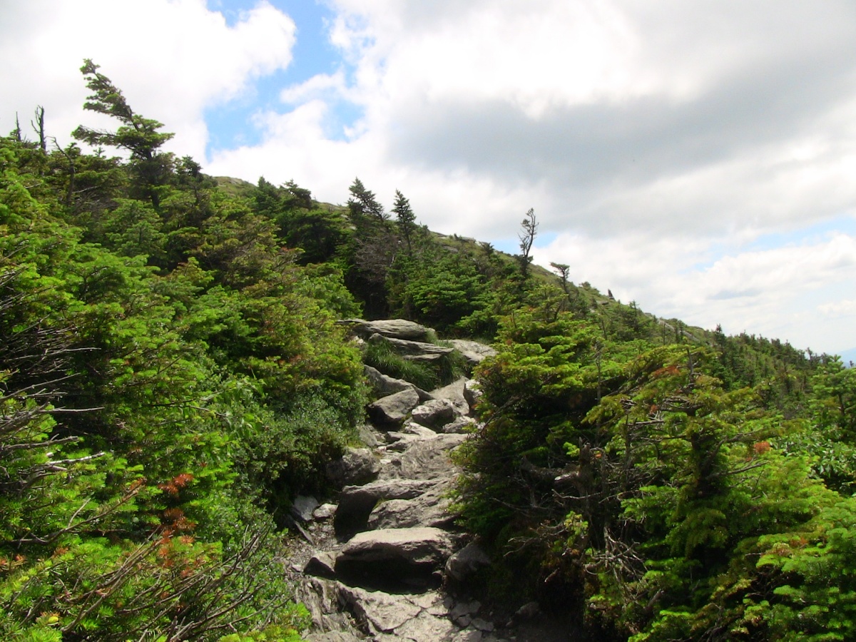
She was trooper and continued on though and by 12:30 we had finally broken out of the cover of trees and into a small clearing peopled by a number of other hikers. This was where we had our first view of the peak and where the Burrows Trail ends.


After chatting with some fellow hikers for a moment, we continued up the final section of the hike (the last 0.2 miles is along the Long Trail). Fully exposed to the sun with the shrinking trees beside us, the views from this point on were excellent and, of course, absolutely beautiful. It does get more steep along this portion of the trail, but no major exposure or technical aspects to report. It was along this section though that Renee's feet began to hurt more and she decided she would stop and wait for me on a little rock landing.


So close to the top, I hurried up the last little bit without her, sad that she wasn't seeing the awesome views that were before me. It truly was the perfect day to take in the full view of the Vermont landscape stretching out all around me. It's no wonder these are called the Green Mountains!
Two and half hours after starting the hike I was on top of Camel's Hump. As would be expected, the 360 panoramic view was pretty incredible and there was quite the collection of hikers (and dogs) taking in the summit views. I took time to take some photos and relax for a little bit on the hump, all the while thinking about Renee back down the trail all by herself.


Not wanting to leave her alone for too long, I soon got my things back together again and started heading down the trail only to find her coming up... "Woo hoo! You made it!". We headed back up the trail and spent the next little while enjoying all the views, this being our first summit together. I was happy to have her up there with me.


Like all great things, it must come to an end and so by 1:30pm we were heading back down the mountain. Considering it was only about 2.4 miles back down I wasn't too worried about anything, but to be honest it sure felt like a long 2.4 miles! It took a little over two hours to reach the parking lot, but for some reason it felt like a bit of a struggle for me at the end. Most likely because of the previous days hike, my knees were beginning to feel a bit sore by the end of it. In comparison, Renee had little complaints but was happy for it to come to an end. As we know, coming down is always the hardest part (physically and mentally). We reached the car by 3:45pm only to now have to make the 4 hour car journey back home to Ottawa. However tired we were, it was still worth every moment. Recommended to anyone who wants a relatively straight forward hike with a nice payoff at the summit.


Hike Information
- Distance: 4.8 miles round trip
- Time: 5 hours
- Elevation: 4,083 feet (1244m)
- Elevation Gain: 2,200 feet (670m)
- GPS Coordinates: 44° 19' 10.37" N; 72° 53' 10.78" W (NAD83/WGS84)
Comments